WalkScore.com — look up your city right now
Below 70, your city loses money. Above 70, your city makes money.
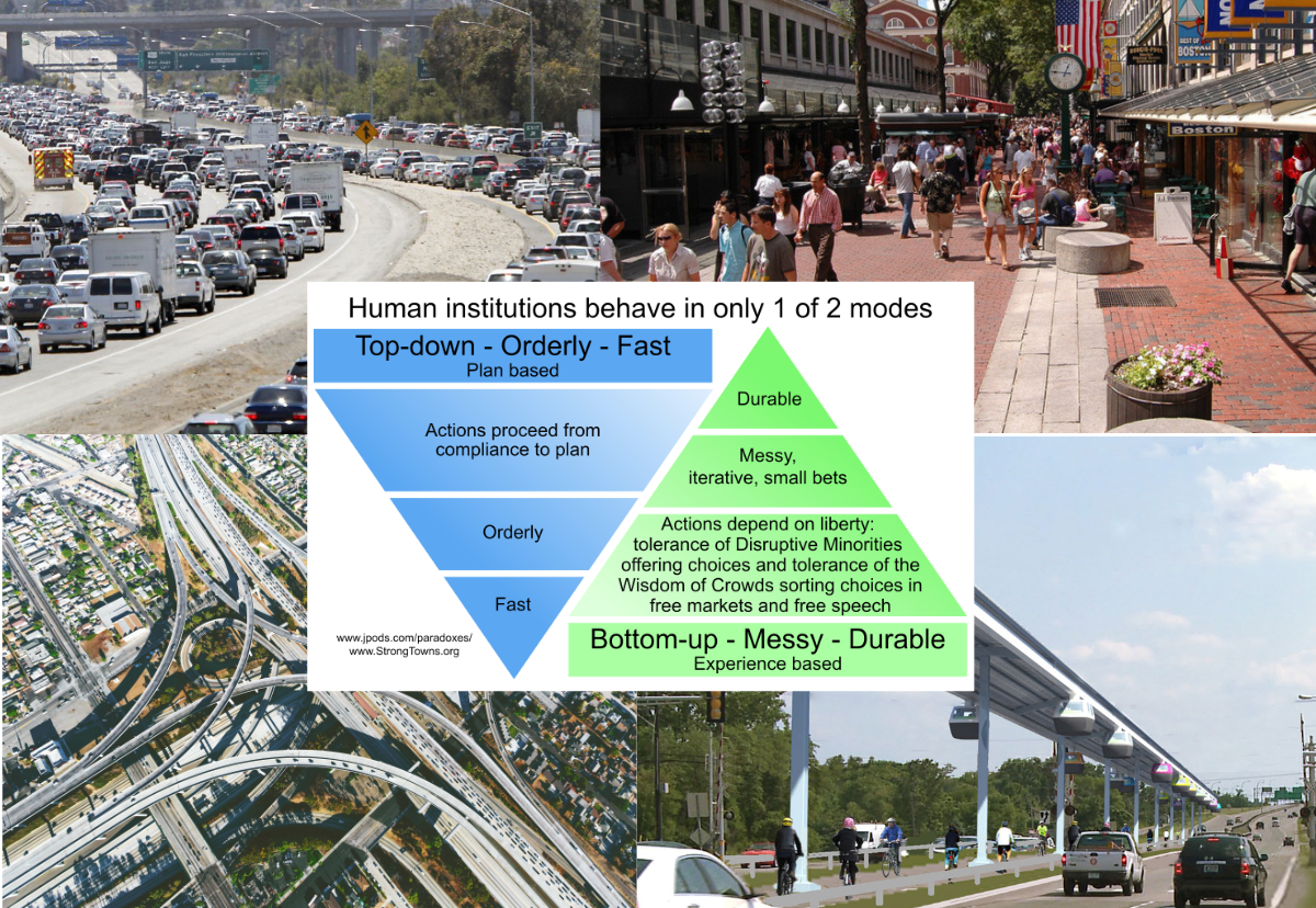
Walk Score and Fiscal Productivity of StrongTown and UrbanThree provide metrics of whether a neighborhood generates more tax value than it costs to maintain its infrastructure. Walk Score of 70 functions as a break-even line for municipal budgeting.
Walk Score
Below 70
Net fiscal drain
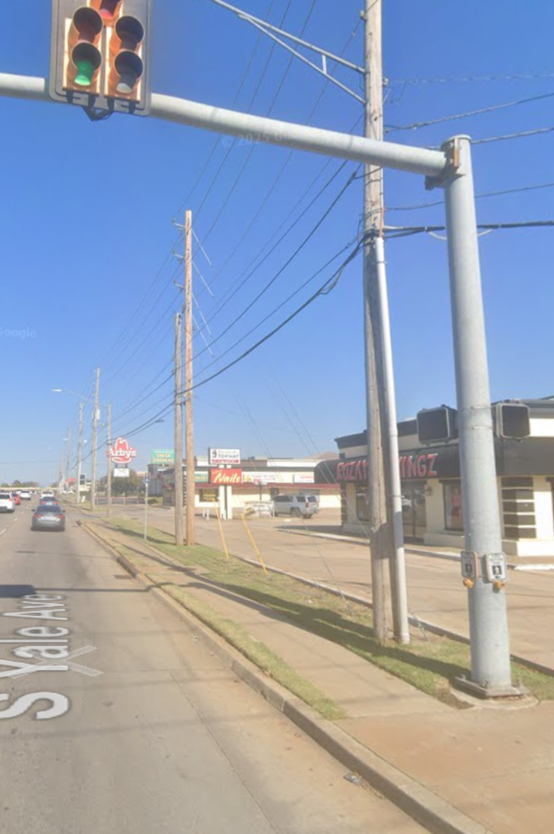
Not fun to walk. Single-use zones. No destinations within walking distance. No street life. Requires a car for every errand. Tax productivity far below infrastructure cost. Your city loses approximately $6,000 per acre per year more than it generates in taxes.
The stroad. The strip mall. The parking lot. The big-box bypass. The subdivision cul-de-sac. The six-lane arterial that killed the businesses on both sides.
70
Walk Score
70+
Fiscally self-sustaining
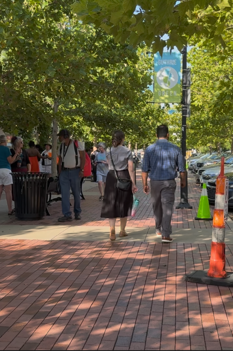
Street life. Eyes on the street. Fun for walking and people watching. Mixed uses. Destinations within walking distance. Tax productivity of $90,000+ per acre per year. Pays for its own streets, pipes, parks, and services. Generates surplus revenue for the city.
Your downtown. Your historic district. The street you take visitors to. The neighborhood farmers market. The block your city gets photographed on.